
The contribution of remote sensing tools to risk management in aquaculture
Marco Pieterse (BlueLeg Monitor), Steef Peters (Water Insight), Daniel Fairweather (Willis Aquaculture Insurance Brokerage), Mark Vos (Crawford & Company)
Aquaculture is a high risk production sector. The industry’s growth has resulted in a concentration of production in key areas, with large loss events a feature of the sector. Insurance, where offered, tends to be expensive and the risk carried by the farmer is significant. New tools available to the farmer and risk professional enable better risk management and facilitate better management practices, codes of conduct, traceability and standard operational procedures. Being able to identify, monitor, and define risk enables the farmer to better control risks facing his operation and can result in reduced insurance premiums and wider coverage.
This paper presents a short overview of the state of the aquaculture insurance industry and the use of innovative remote sensing tools for monitoring specific risks related to Harmful Algal Blooms.
Introduction
| Turquoise swirls in the cool Barents Sea north of Norway are caused by a bloom of phytoplankton |
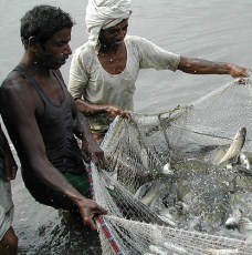
Fish farming as a sector is growing massively on a global basis. Aquaculture has an estimated global production value of €75 billion - with salmon farming having grown 10% year on year for the last 20 years. Wild fish catches have been static for the last 25 years, and the growing shortfall in fish supply must be met by aquaculture
Despite the size of the industry in monetary terms, insurance as a risk management tool has made limited inroads in aquaculture. Industry sources estimate that less than 3% of all aquaculture operations are insured globally. Insurance coverage is primarily focused on large scale professionally managed farms, with typical premiums between 3% and 5% of the insured sums, indicative of insurers’ perception of the risk within this industry.
The global reinsurance company Swiss Re recently presented an overview[1] of the major causes of global insurance claims in aquaculture. These are listed in descending order: diseases, storms, algae and jellyfish bloom, equipment failure and ‘super chill’ (extremely low winter temperatures leading to freezing of coastal waters).
Here we focus on one particular risk, hazardous algal blooms, which severely impact aquaculture. During a bloom, the oxygen content of the surface water is reduced, toxins can be released and direct contact of algae with fish gills lead to high fish mortality or significantly reduced growth.
Scientists generally agree that there are three main reasons for the observed increase of algal blooms:
1. global warming (favoring growth of algae)
2. increasing run-off of nutrients like phosphates and nitrates into surface water
3. introduction of invasive species by ballast water of ships.
If a bloom is detected fast enough, farms have a number of measures they can take to mitigate the impact of a bloom including:
- stop feeding (encouraging the fish to stay deeper in the water column)
- deploying “plastic skirts” or tarpaulins around the cage as a barrier
- using compressed oxygen pumps in the cages and/or pumping up unaffected water from deep under the cage site
In a number of major aquaculture producing countries, such as Canada, Scotland, Ireland, Chile, Australia and South Africa the risk of algal blooms near fish farms is significant. Recorded incidents of algal bloom have resulted in losses of tens of millions of dollars to fish farmers and insurers. Example cases of algal bloom damages include an estimated loss to the Southern Chile salmon industry of over US$ 25 million in 2009, a red tide affecting abalone production in Fujian, China with damages estimated at over US$ 35 million in 2012 and a recent 2013 outbreak in Tasmania, Australia with losses for the shellfish industry estimated already at over US$ 20 million.
The role of remote sensing in aquaculture for risk assessment and control
BlueLeg Monitor and Water Insight of The Netherlands have developed a series of satellite and handheld remote sensing products and services for aquaculture. These enable farmers and insurers to assess the algal bloom risk within an area based on historical data stretching back over 10 years. The historical records enable a baseline analysis to give a good impression of the progressing environmental impact of aquaculture operations. Additionally, insurers and loss adjusters may also benefit from this and other remote sensing services in evaluating damages.
The BlueLeg Monitor system is based on the combined use of optical data from satellites and mobile monitoring instruments giving real time, on the spot data collection. These in situ instruments have been developed both for hand held applications and fixed position use. Satellites monitor large areas (typically in a range of hundreds of kilometers) once per day. Hand held/mounted (WISP) units monitor and assess local water quality at any time during daytime. The data of both systems are interpreted by the same methods and combined to provide very reliable measurements. Current and historical optical measurements can be converted, using state-of-the-art proprietary algorithms, into relevant water quality indicators such as chlorophyll-a, phycocyanine (blue algae pigment), CDOM (colored dissolved organic matter), water transparency (Secchi disk depth) and total suspended matter.
WISP monitors are currently being used all over the world, from the Dutch Ministry of Waterways responsible for water infrastructure and water quality and the Amsterdam Water Authority Waternet , through to national environmental institutes such as the Australian CSIRO and the Finnish Syke, among others.
Outlook
The growth in aquaculture, with the support from industry participants including insurers, is set to continue, and with it the requirement to grow sustainably. By identifying, monitoring and managing risks, the ability to grow sustainably increases, thereby benefitting all supply chain actors within the industry with support expected to increase as the ability to asses risk improves.
Wider applications of remote sensing technology are already assisting other industries to monitor key risks, with terrestrial farming, heavy industry and environmental stakeholders using satellite imaging on a daily basis.
Remote sensing of algal blooms and the monitoring of these events on aquaculture operations globally is an important tool improving risk assessment and management in aquaculture.
References
Van Anrooy, R.; Secretan, P.A.D.; Lou, Y.; Roberts, R.; Upare, M. Review of the current state of world aquaculture insurance. FAO Fisheries Technical Paper. No. 493. Rome, FAO. 2006. 92p.
Rosema, Andries FESA Micro Insurance: satellite indices breakthrough, FARMD 2012
Contact
Marco Pieterse ([email protected]), Dr. Steef Peters ([email protected]), Daniel Fairweather ([email protected]) and Mark Vos ([email protected])
[1] AUMS 2013, 13th Aquacultural Insurance and Risk Management Conference Istanbul